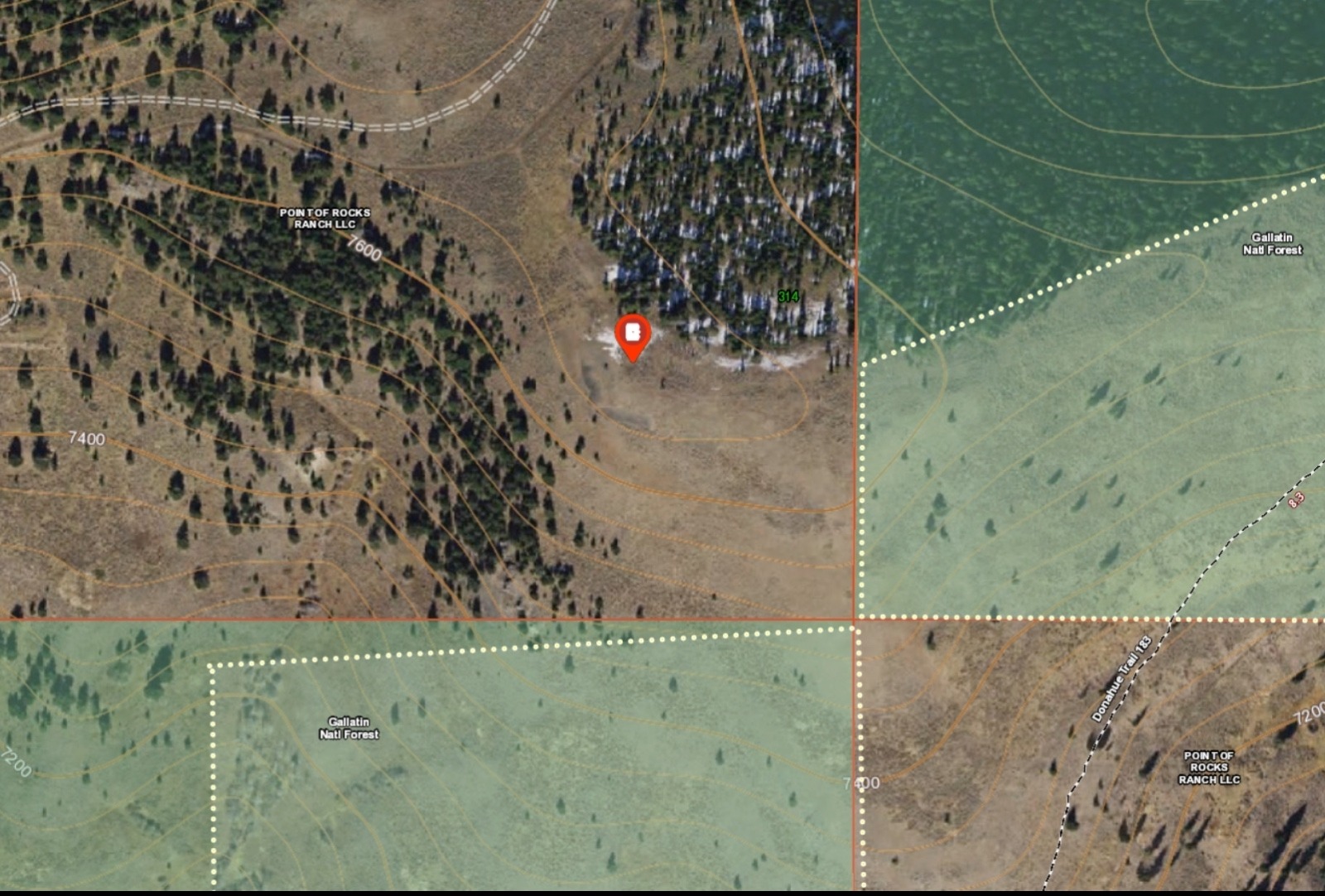
"The areas inside of the dotted lines (along a 2.8-milesection of strenuous uphill trail) are the only public land tracts that could even possibly provide that vantage point," Bongofsky says. "The red pin marks the end of a fourwheeler spur trail off of Point of Rocks Ranch. The Google Earth view lines up perfectly with the photo from Rosendale's Tweet. Note that the public trail is more than 300 feet of elevation lower.

