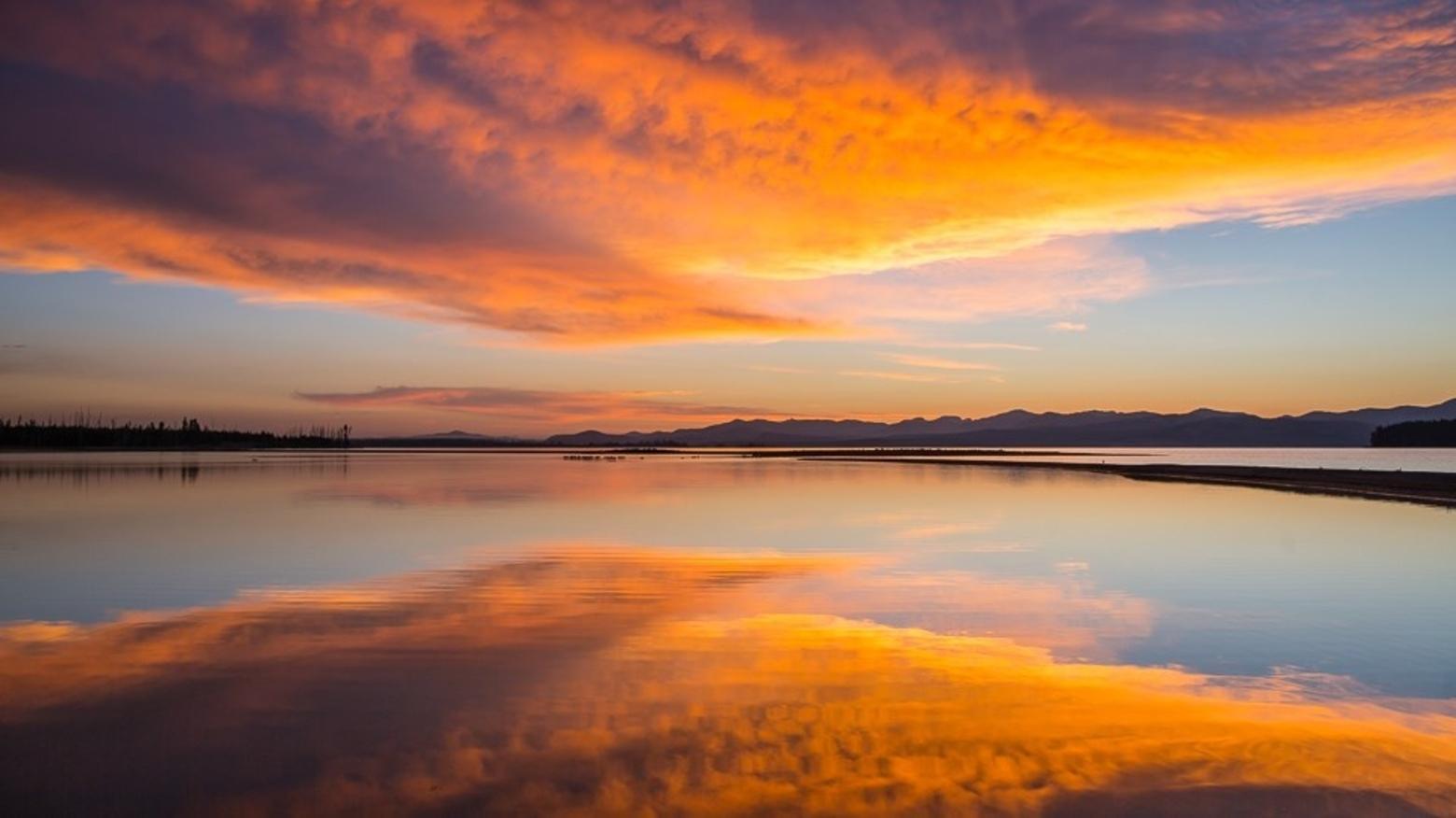
By tracking the level of Yellowstone Lake over time, it's possible to understand more about a range of subjects, from the hydrology of stream flow to the physical properties of the magma reservoir beneath the Yellowstone Caldera. Photo by Neal Herbert/NPS
EDITOR'S NOTE: Yellowstone Caldera Chronicles is a weekly column written by scientists and collaborators of the Yellowstone Volcano Observatory. This week's contribution is from Scott K. Johnson, science communication associate with the EarthScope Consortium.
by Scott K. Johnson
The importance of tide gauges is apparent to anyone who has lived near a coastline, but there are a host of reasons to measure the water level of inland water bodies, too. Sometimes that’s to monitor water cycle trends, like droughts. But there can also be important shorter-term variations, like when storm winds push water toward one area in the Great Lakes—a phenomenon known as a “seiche.” Seiches are measured on Yellowstone Lake, too, but here they are driven by particularly unique processes.
There are multiple records of water levels in and around Yellowstone Lake. Flow at the lake’s outlet into the Yellowstone River has been measured as far back as 1913. Additionally, daily readings of lake level—currently performed at Fishing Bridge—have been noted since 1921. And since 2017, an instrument has been automatically recording precise water levels minute-by-minute near the Grant Village boat dock in the West Thumb of Yellowstone Lake.
The story behind this recent addition begins with the installation of five borehole strainmeters in the park in 2008. Instruments used to monitor the volcanic system, strainmeters measure subtle flexing of the bedrock over time. An odd pattern appeared in one instrument’s data that was thought at first to be noise from some electronic component. But when it was seen in multiple instruments—and when it was found to correlate to the Yellowstone River outlet flow—it became obvious the strainmeters were measuring something real.
[A declining snowpack] will have significant impacts on seasonal water flows—average peak annual streamflow has already moved over a week earlier than it was in the 1950s, with low flows in late summer now lasting longer.
It turns out that seiches in Yellowstone Lake shift enough water mass back and forth to squeeze the bedrock. In most places, this effect would be far too weak to measure even with these ultra-sensitive instruments but because of the magma reservoir beneath Yellowstone, the bedrock is easier to depress. This actually provided a useful way to measure the physical properties of the bedrock and magma reservoir, a bit like seeing how far you sink into a mattress to test its firmness.
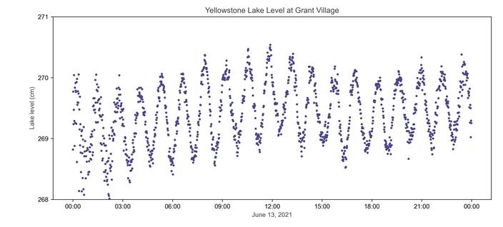
Lake-level sensors were used to learn more about the seiches themselves. Even when strong winds aren’t blowing, a small seiche still ebbs and flows in a cycle a bit longer than an hour, with water levels changing by a few centimeters or more in portions of the lake. This may be related to
An example of the repeating seiche—a long-period oscillatory wave that can be present on a lake—measured over the course of a day by the lake-level sensor at the Grant Village boat dock on the West Thumb of Yellowstone Lake. Figure by Scott K. Johnson
the lake-bottom hydrothermal system, which provides energy that makes the water level bob up and down.
By tracking this process over a long time period, we might be able to observe variations that tell us something about the volcanic system—similar to monitoring for changes in seismic activity or ground movement.
The lake-level sensor was damaged by ice last winter, so EarthScope Consortium engineers recently paid it a visit for repairs. Water level measurements often use pressure sensors—one below the water line and one in the open air so that changes in air pressure don’t affect the water depth measurements. At this site, a cell modem is also used to transmit the data out. With everything fixed up, the station is recording and communicating its data once again.
Now that the station has been monitoring lake levels for several years, year-to-year differences in weather are also visible. For example, lake levels declined between 2017 and 2021 before they rebounded in 2022. Climate projections for the region include further changes in snowfall and snowpack as temperatures warm. That will have significant impacts on seasonal water flows—average peak annual streamflow has already moved over a week earlier than it was in the 1950s, with low flows in late summer now lasting longer. Water data at another location can only help to provide a more complete picture of the changes around Yellowstone, and there are plans to install additional lake-level sensors around Yellowstone Lake in the coming years.
Measurements are the lifeblood of science, and the longer a dataset runs continuously, the more useful it becomes for detecting change. In this case, simple lake-level data are valuable to multiple fields of research, from geology to hydrology. And whenever we measure something in greater detail, we have a chance to discover an interesting process that was too subtle to see before.
About Scott K. Johnson
Scott K. Johnson is science communication associate with EarthScope Consortium, which collaborates with the Yellowstone Volcano Observatory.